Maps Module
Access Maps module from the main screen. This is used to create graphics for maps and animations. User can also further filter down the target area and access the saved assets from the Track module at any time.
Begin by creating a new map graphic, or animation and save it to Track repository.
- Access Maps Module.
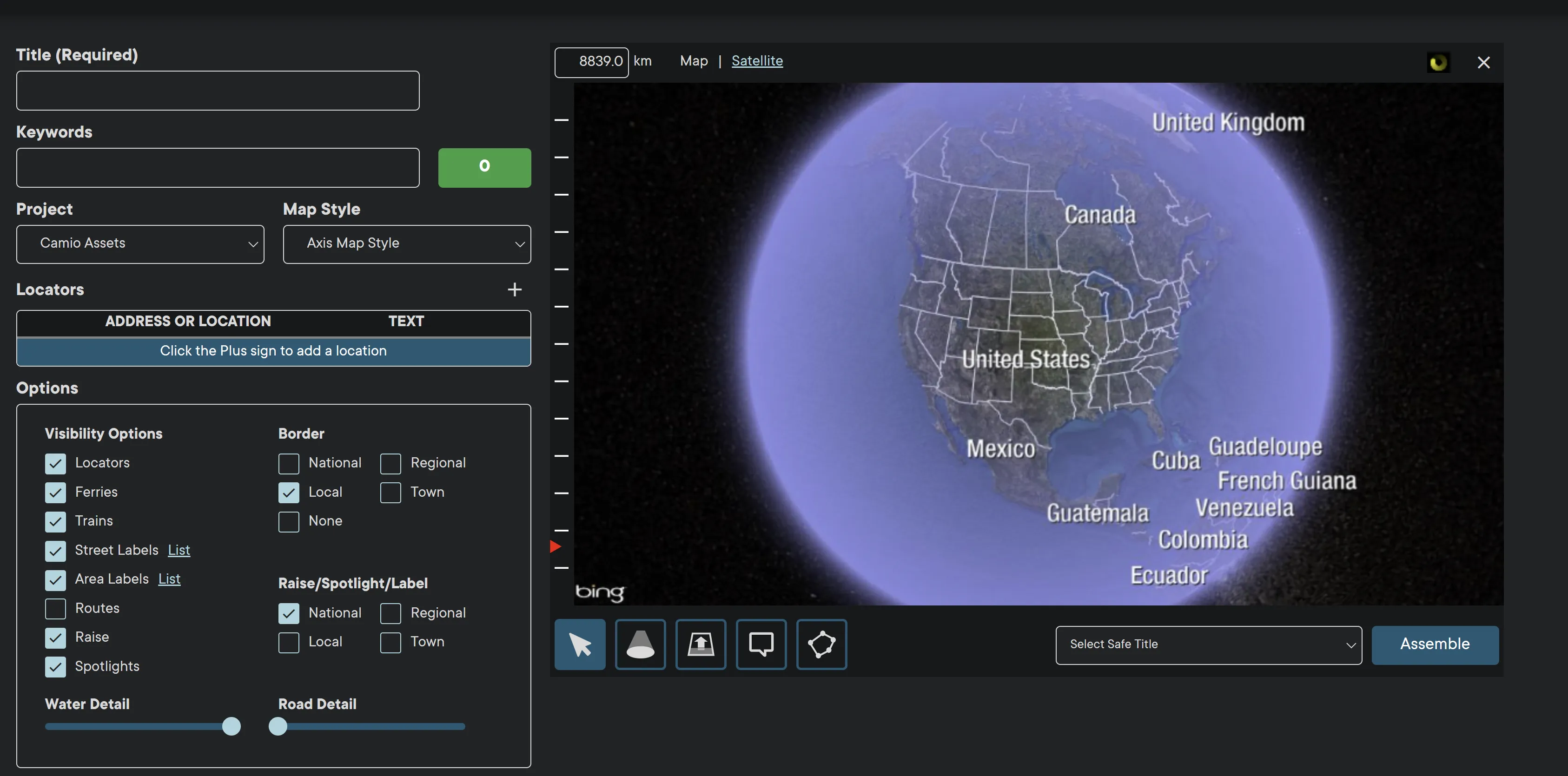
- Enter a Title in the Title field.
- Select a Project form the Project dropdown menu.
- Select Map Style form dropdown menu.
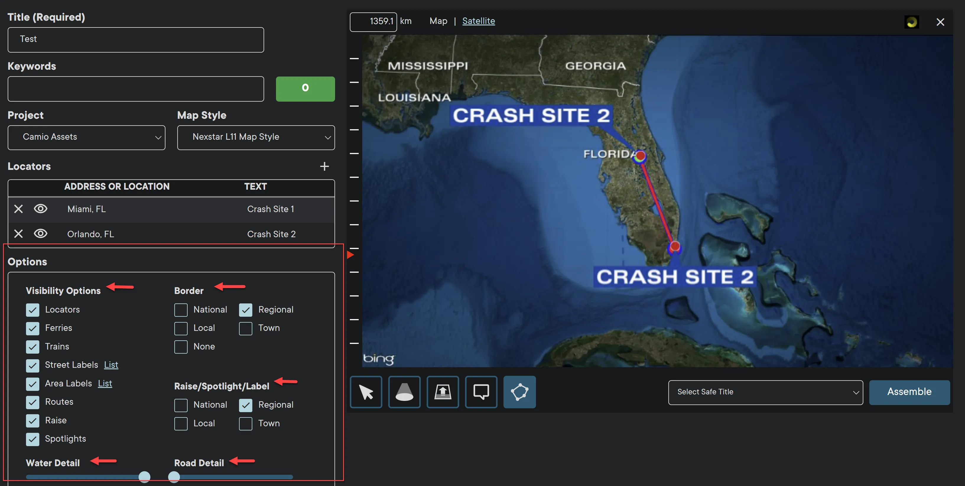
- Click the Locator + button to a location. User can add multiple map locators.
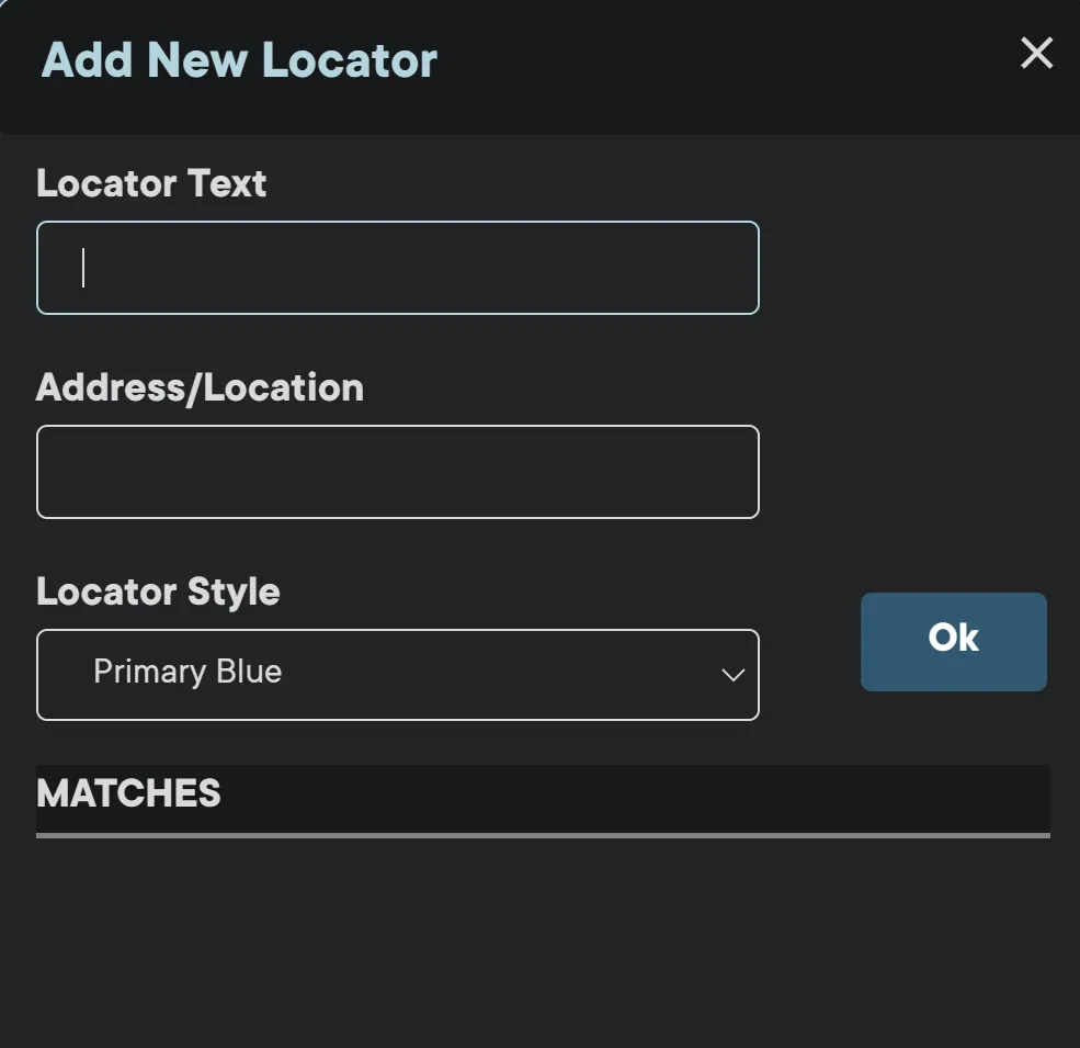
- Enter name in the Locator Text field.
- Enter Address where the locator will be pinned.
- Select Locator Style (Primary Blue is default)
- Click OK button.
- Similar Address/Location list may populate with suggested options.
- Select the desired option to add New Locator to the Map.
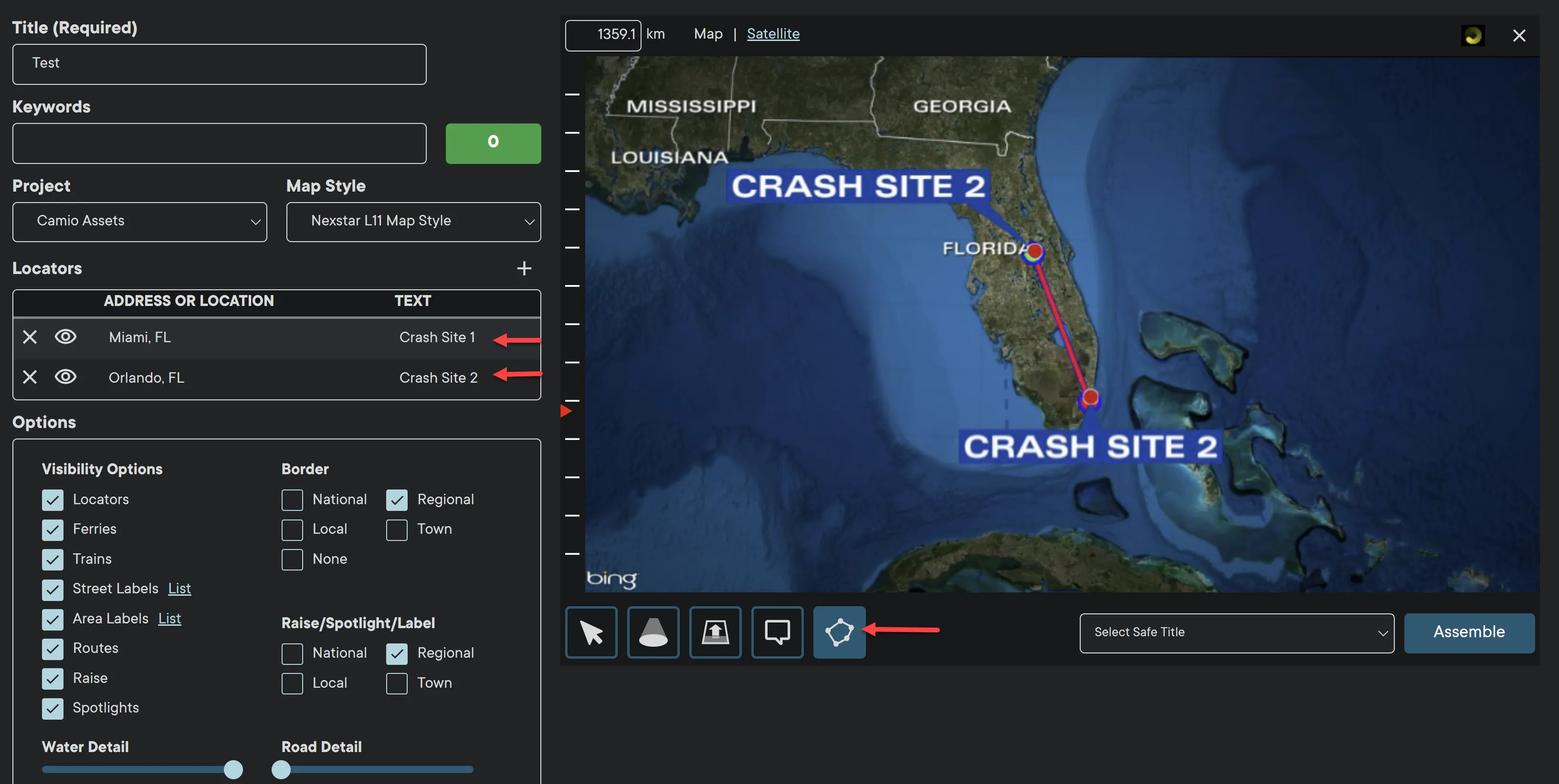
The locator graphic will populate on the Map with the entered text.
- Click on the Route button to add a path from Site 1 to Site 2
- Click and drag the locators to fit the screen and leave enough room for the Safe Title to be added once the map is complete.
You can add up to three locators on one map.
The select button allows user to select a specific area on the map and control the level of detail.
Options include:
- Visibility
- Border
- Raise/Spotlight/Label
- Map Zoom
- Water Detail
- Road Detail
The more Options are enabled, the greater the details on the map.
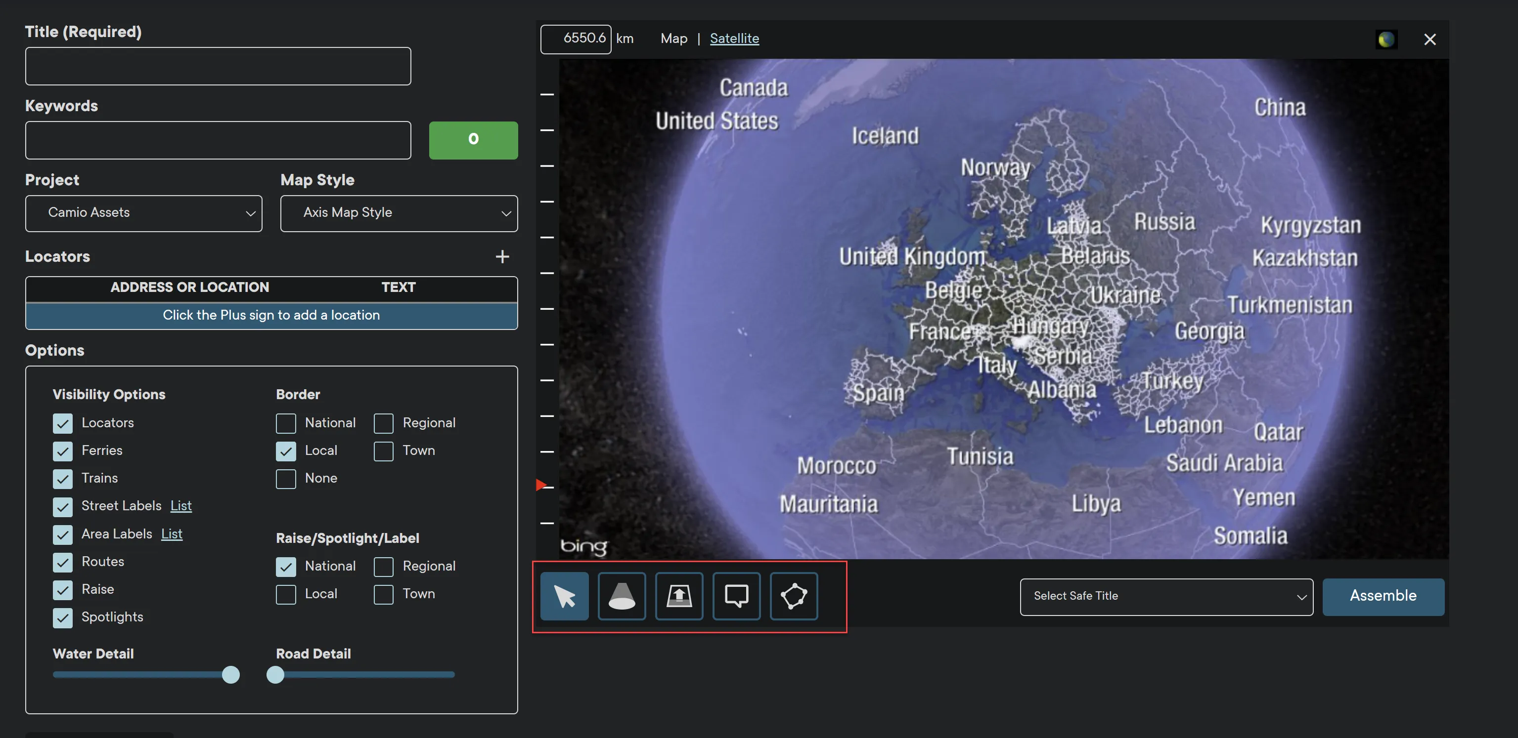
Additional functions are located at the bottom of the Map.
- Move - click and drag mouse on the Map to change the view.
- Spotlight - Highlight an area on the Map.
- Raise - Raise/highlight an area on the Map.
- Custom Locator Map - Add a locator to the Map.
- Route - Connect multiple Locators with a route.
Maps Superusers at the Group and Station level can define Safe Title Templates for users in their organization. Safe titles are used to guide users to avoid areas that will be masked by other graphics such as station logos and lower thirds.
Note: Safe titles are uploaded as PNG images with alpha. They should be the resolution that matches the Maps format (1920x1080 or 1280x720). One of the safe titles can be selected to be the default the users see when they first log in.
IMPORTANT: Before saving the graphic, make sure to leave enough space for the Safe Title asset.
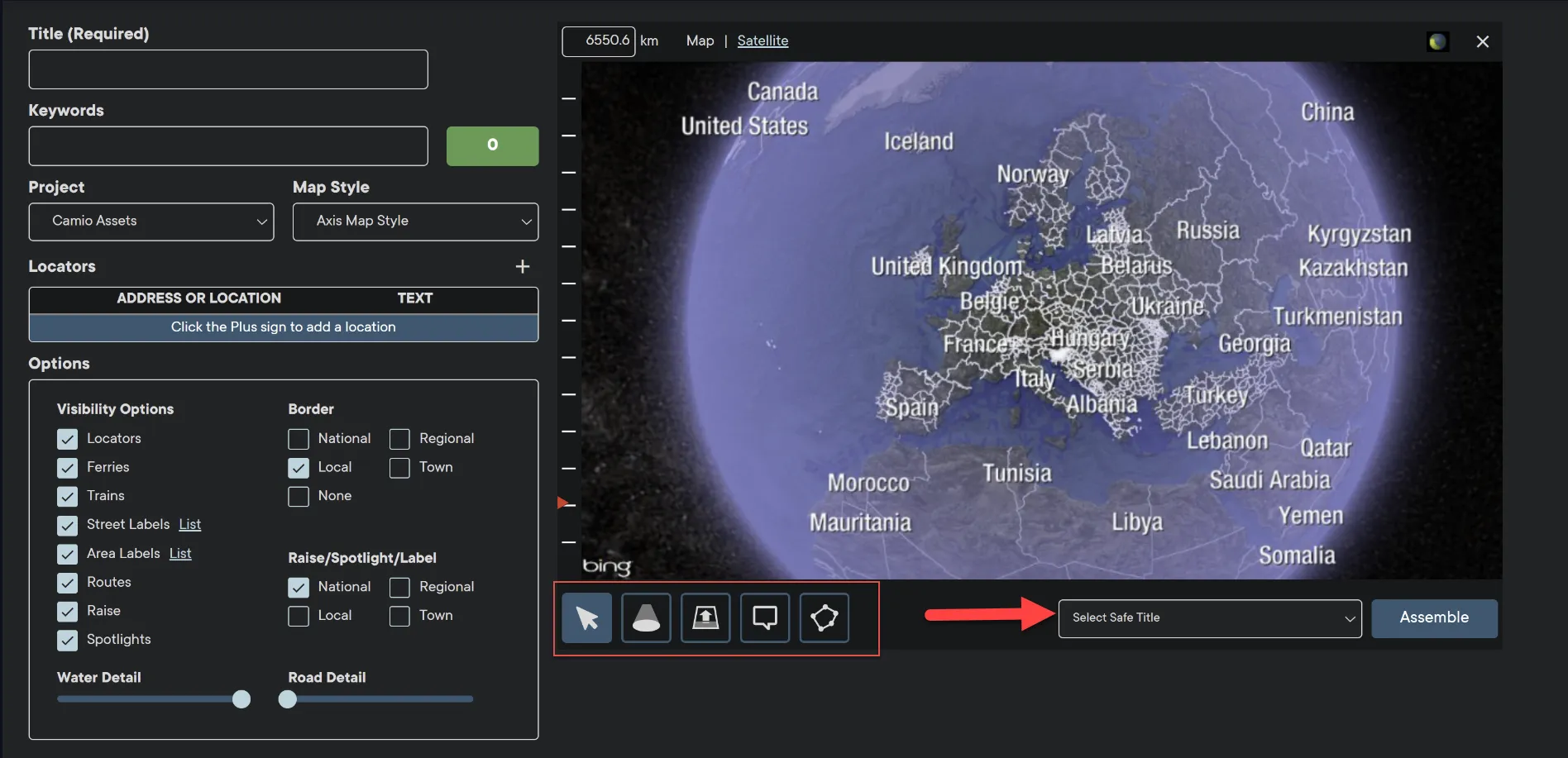
Once the Map is complete, click Assemble to save the asset to Axis Track repository.
In addition to graphics, Axis allows users to combine multiple graphics and produce animations.
Note: The user must have Animation permission enabled by a superuser.
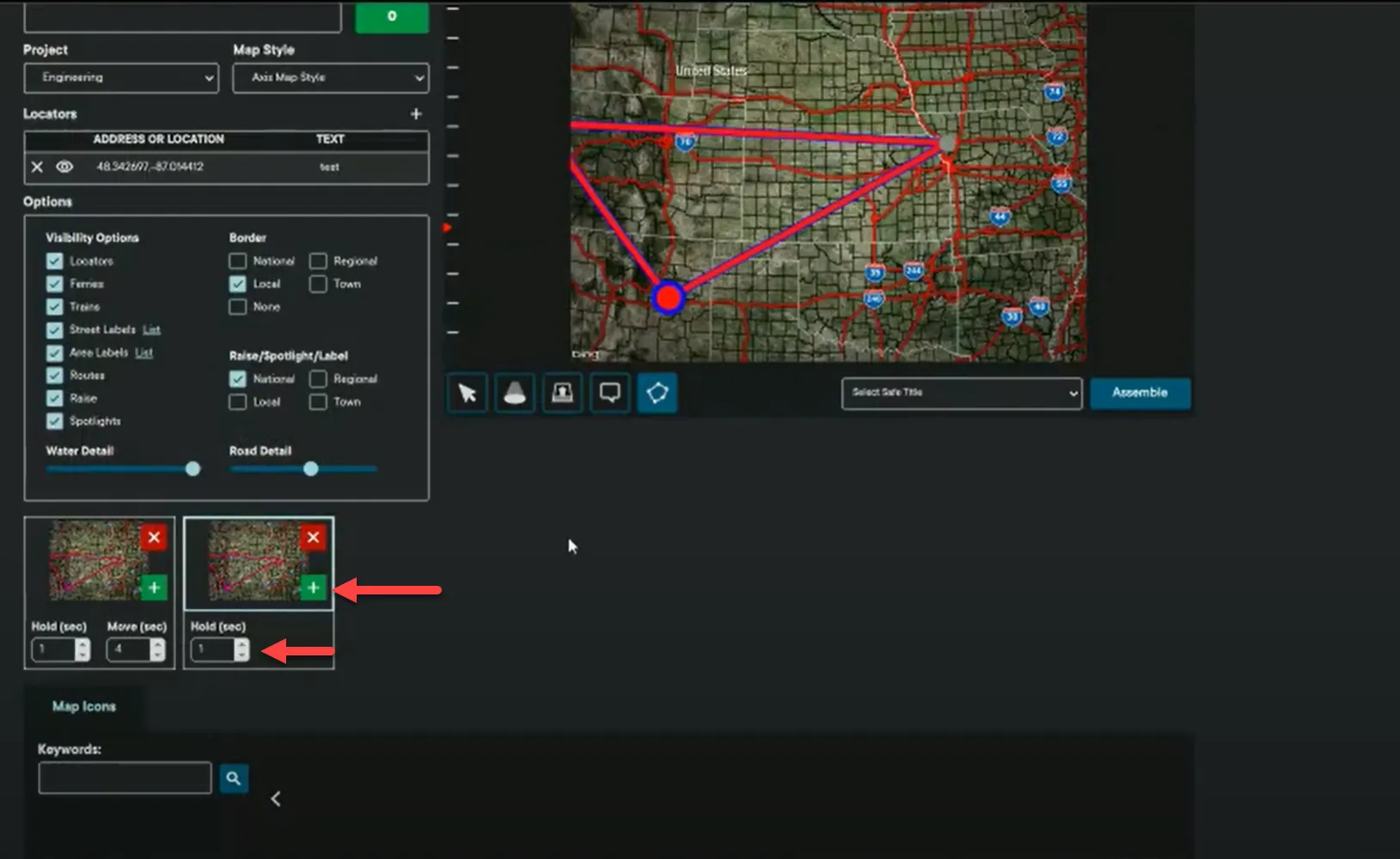
The animation clips will populate at the bottom of the Maps module.
- Select Hold seconds to set how long the animation will remain still before zooming into an area.
- Select Move seconds to set the length of the motion graphic to complete it's loop.
- Click the green plus button to add another animation and set the same hold and move times.
- You can combine multiple animations and move to multiple locators for a maximum of 20 seconds.
- Click red X button to delete a clip.
